Agri Sense

Conceptual Product Solutions (APD2) 2024

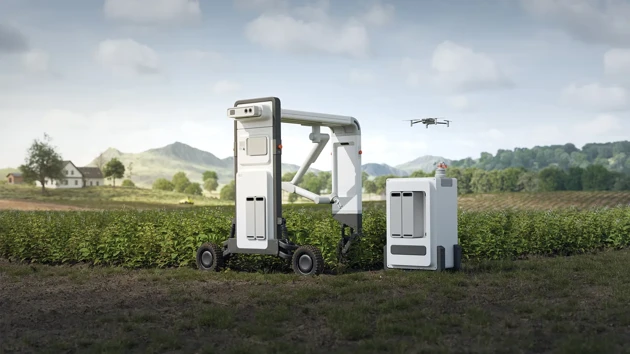
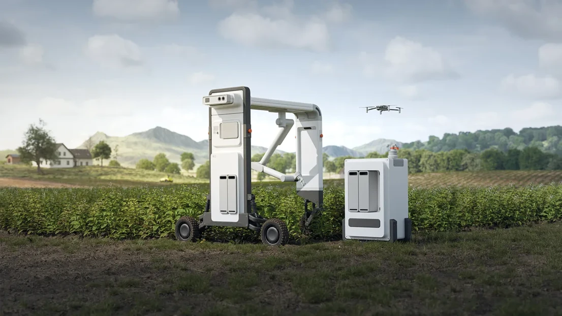
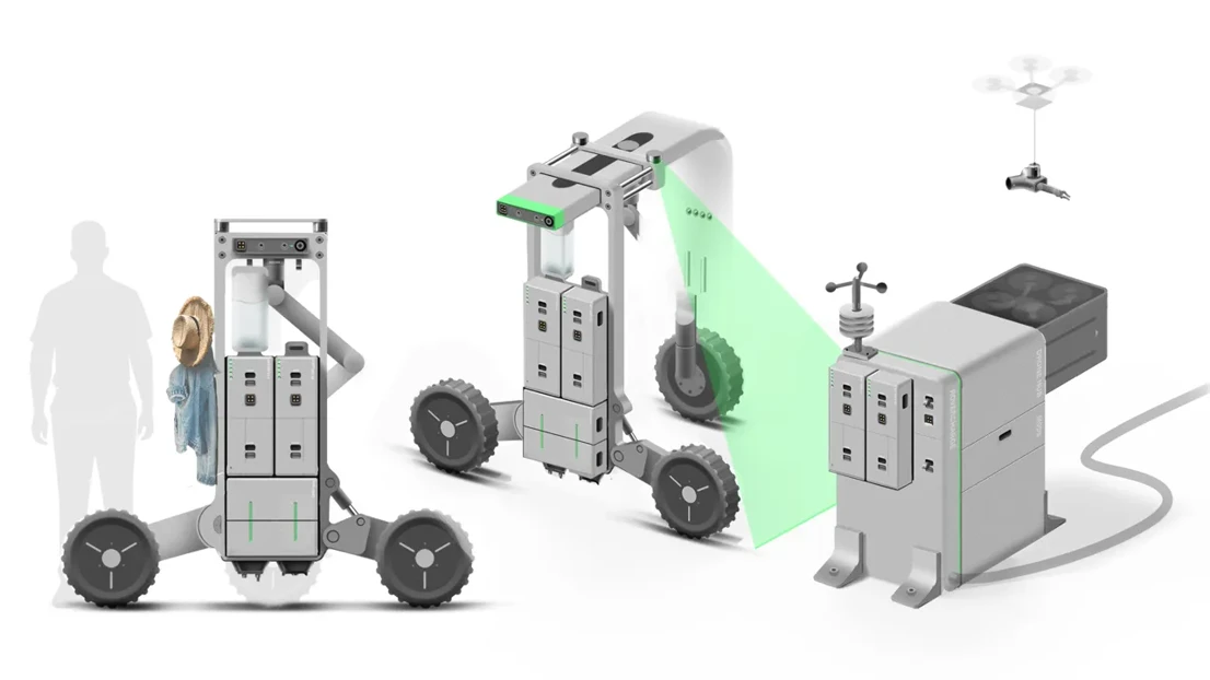
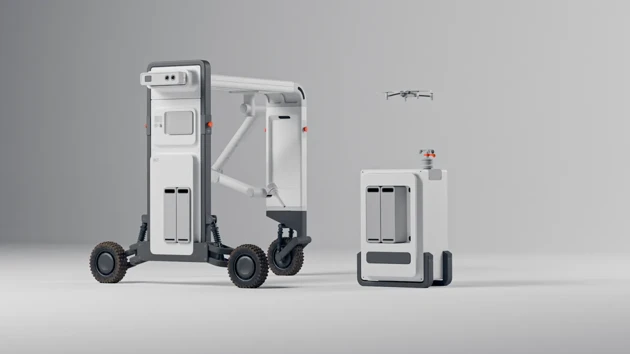
Keeping up with the rising food demand of the world’s growing population is a big challenge for farmers. Climate impact made it even harder, and the costs of resources have been rising significantly. To deal with these challenges, farmers have tried practising precision farming, a technique that uses location-based data collection on the field for making informed decisions for precise and sustainable crop management. The data collection system Agri Sense can help farmers with this. The drone can quickly fly over the fields and map them out. The Rover constantly roams the fields and collects precise physical data, which provides the farmer with valuable information about both the soil and the crop. The rover’s AI can detect the presence of pests and diseases and helps the farmer to react quickly and keep them from spreading.

Background

By 2030, the world’s population will grow by almost 1 billion, and food demand will increase by 50 percent. Farmers are facing a lot of challenges keeping up with the demand, but climate impact makes it even harder. The farmers have to adapt to changing conditions and more extreme weather events. Additionally, new pests and diseases are spreading, and the costs of resources like fertilizer have been rising significantly. Farmers are also under a lot of pressure to reduce their emissions and prevent harming the environment by overfertilization or the overuse of pesticides and herbicides. To deal with these challenges, farmers have tried practising precision farming, a technique that uses location based data collection on the field for making informed decisions for precise and sustainable crop management. A lot of the data collection tasks need to be done in time-consuming manual work. The labour shortage in the agricultural sector makes it even harder to do the necessary measurement in a consistent, thorough way. As a result, the quantity and quality of the data varies greatly. Interpreting the data in the right way needs operators with profound knowledge of data analysis, and the transition from data collection to the application in the field is often difficult.

Process

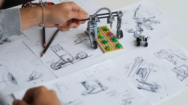
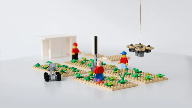
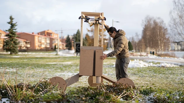
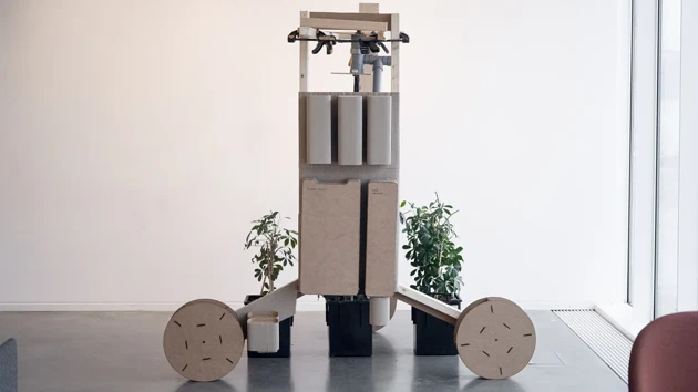
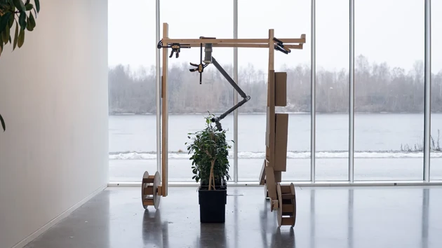
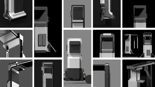
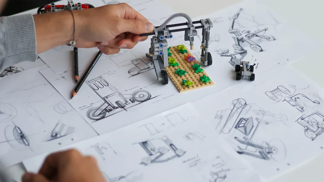
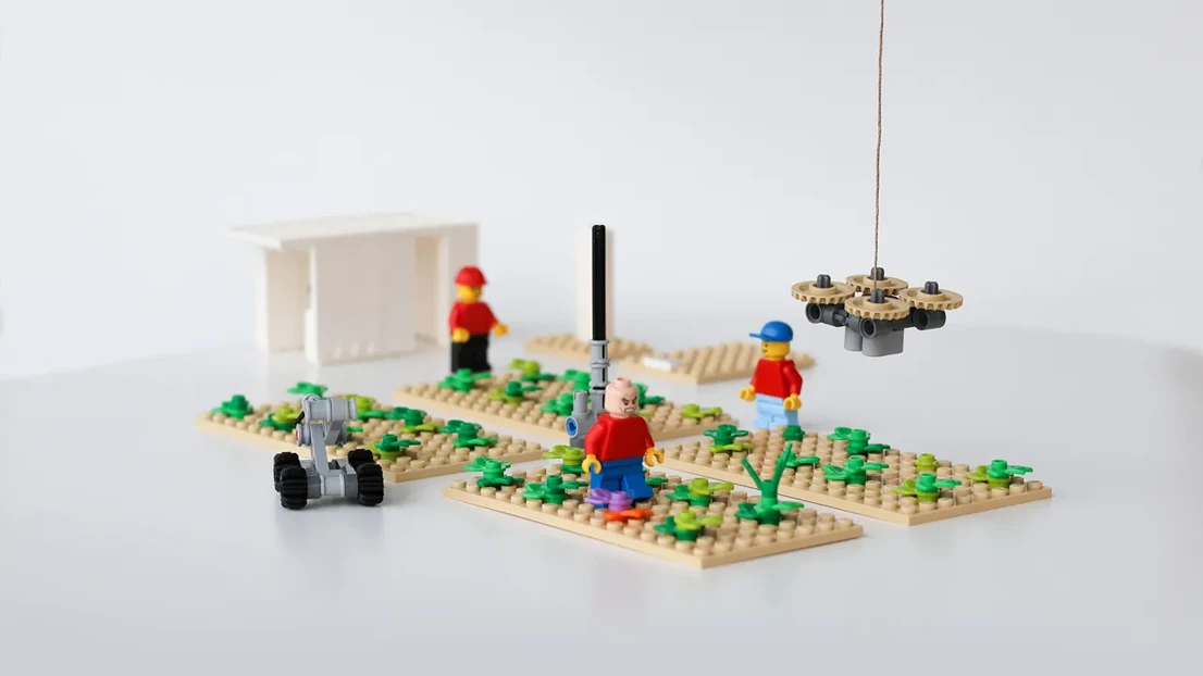
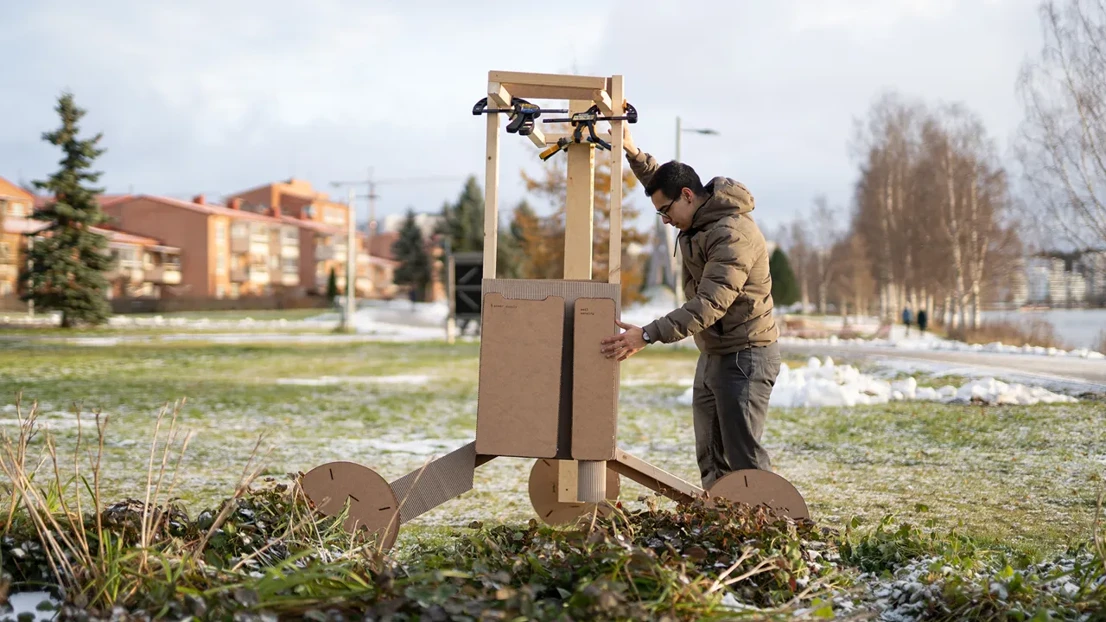
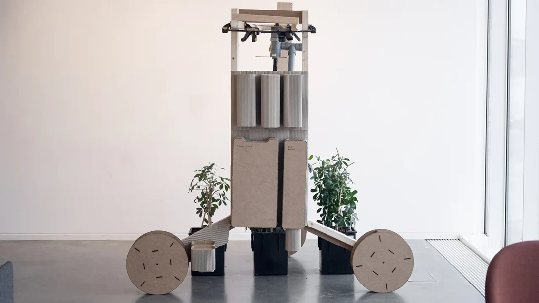
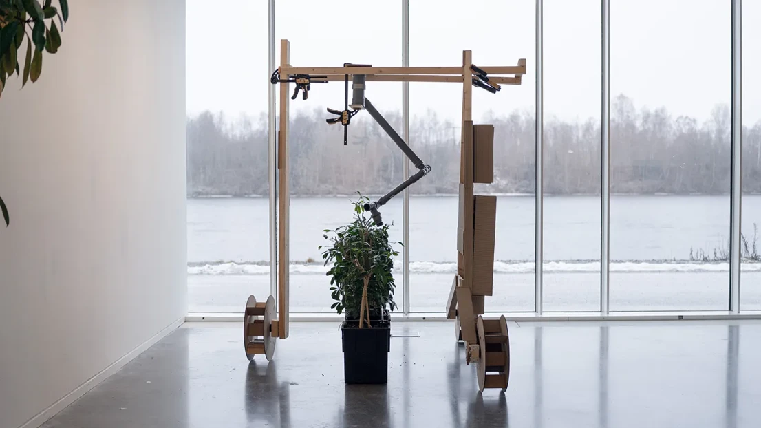
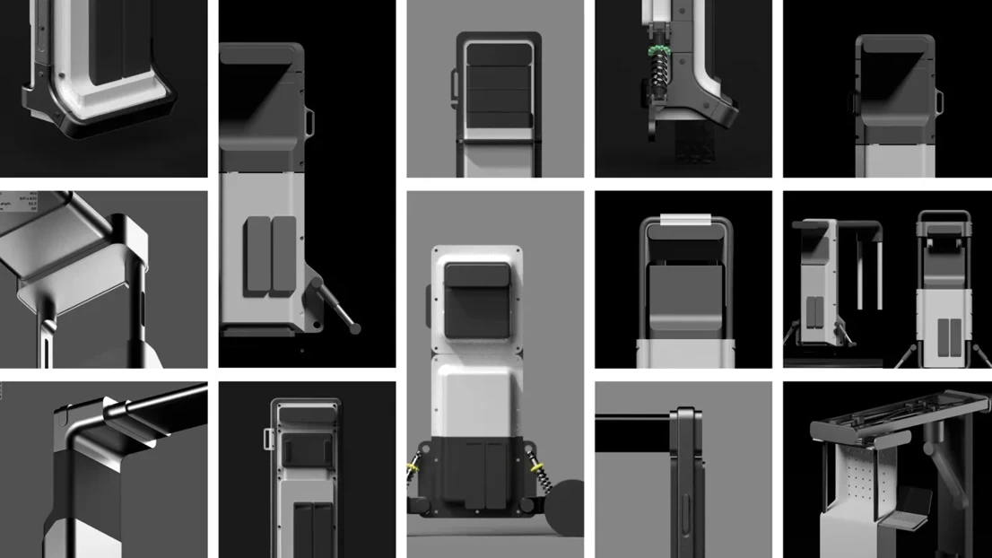
The main goal was to develop an autonomous solution that would help with practising precision farming without creating additional work for the farmers. Through thorough desktop research we defined what parameters should be measured, and what technical approaches would be the most suitable. We aimed for creating a modular system that can be adapted to different use cases in an easy way. By thinking through a fictional scenario of a Danish farmer‘s collective, we imagined a business model based on a sharing economy. Creating 1:1 cardboard mock-ups helped us to define size, proportion and functionality of the different elements.

Result

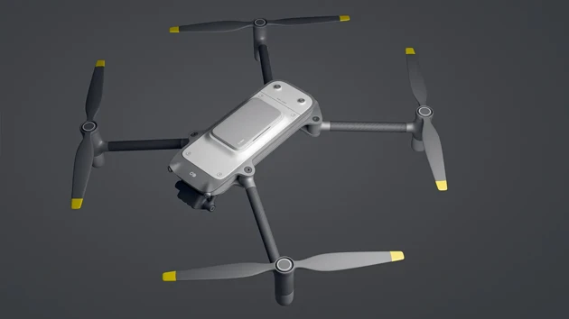
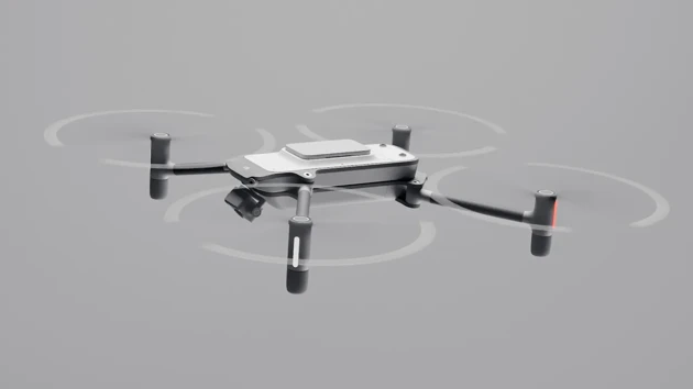
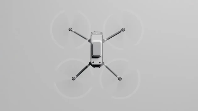
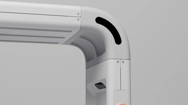
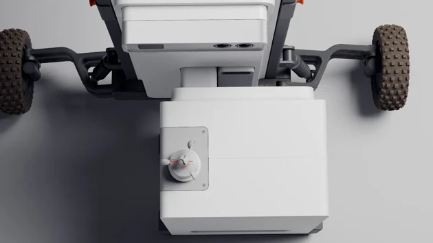
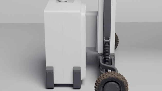
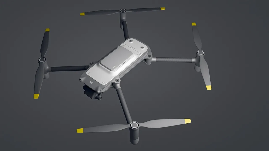
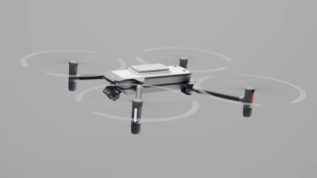
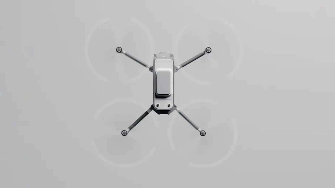
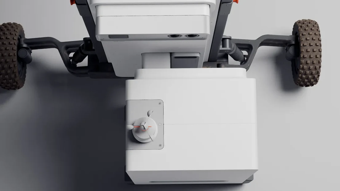
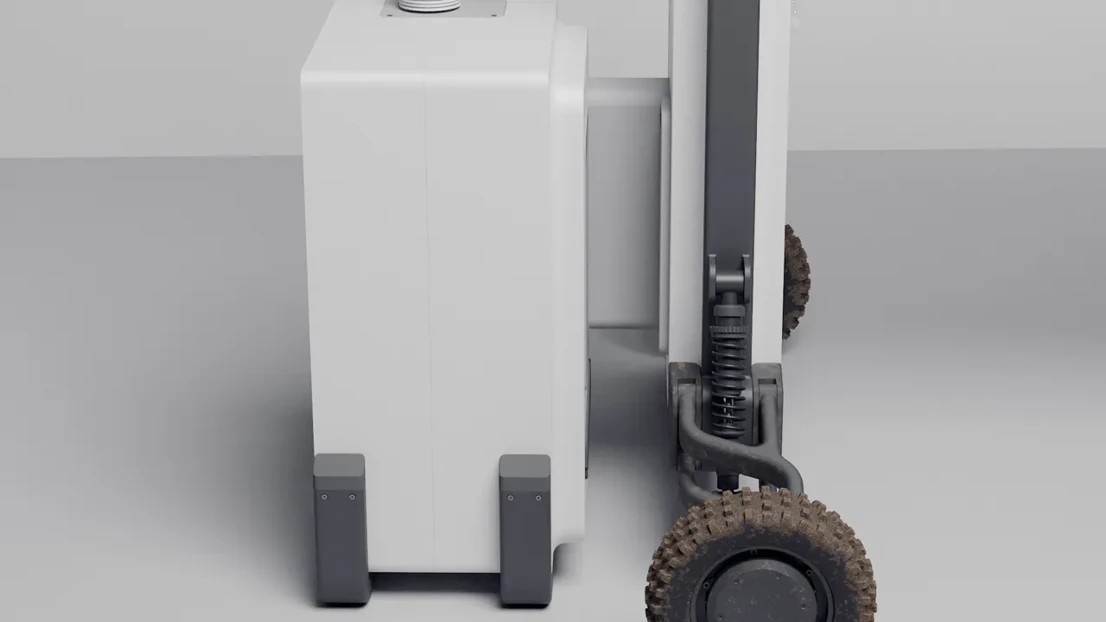
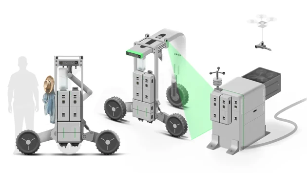
The Agri Sense system consists of 3 main parts: a ground vehicle, a station, and a drone. The drone can quickly fly over the fields and map them out. It can estimate certain crop data like nutrition using multispectral imaging , and it then divides the field into sections based on the collected data. The drone can be automatically charged and stored in a drone hub that can be attached to the station. The station serves as a central element to charge the drone and the rover and enable autonomy.

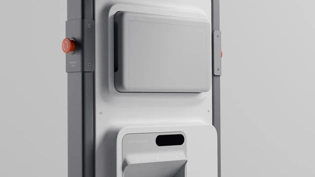
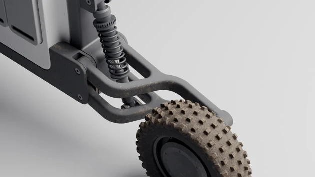
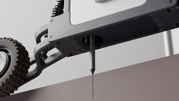
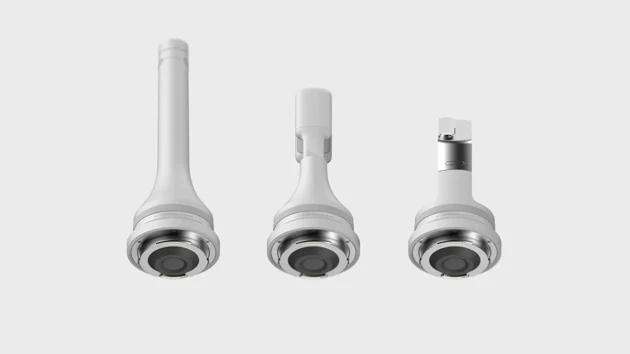
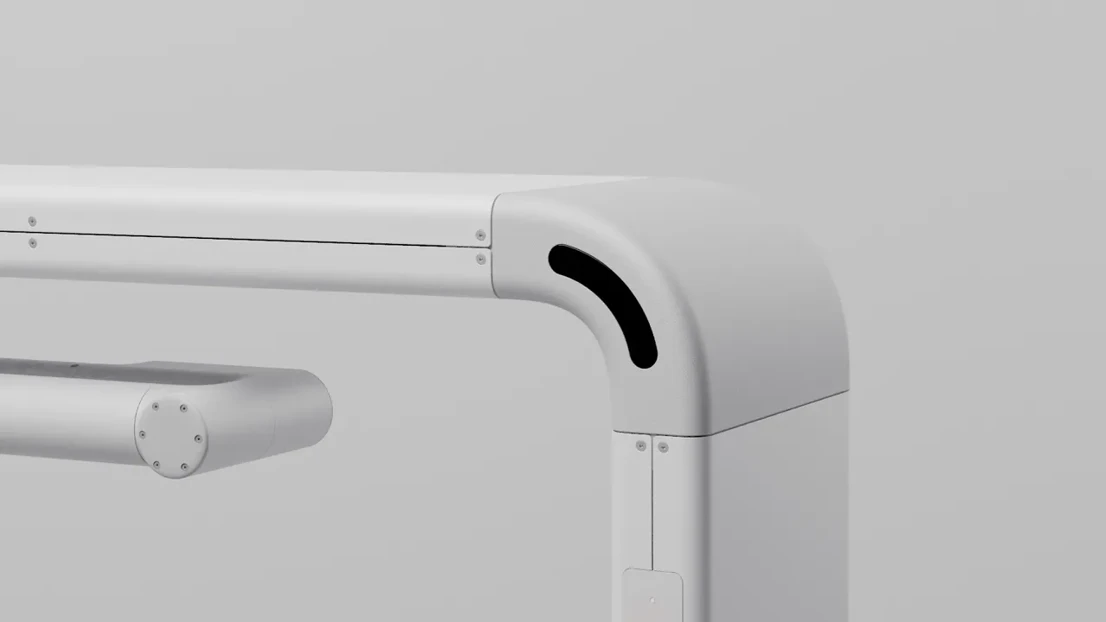
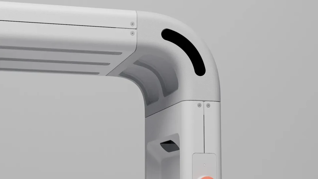
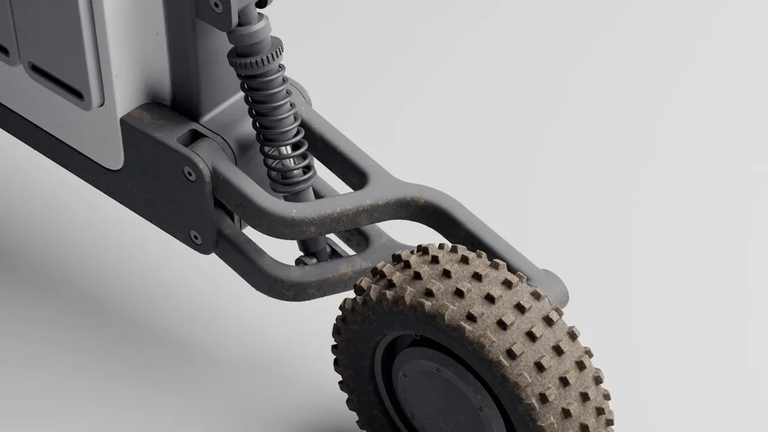
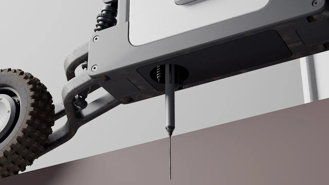
The Rover roams the field constantly to collect precise physical data. That includes measuring critical soil properties like humidity, pH and nutrient levels. A hydraulic piston located in the main body of the rover can switch between a range of sensor probes, a soil sampler, a compaction tester and a spectrophotometer to analyze different soil properties and take samples. The rover can be equipped with an additional module for automatically storing and labeling physical soil samples for the analysis in a laboratory.

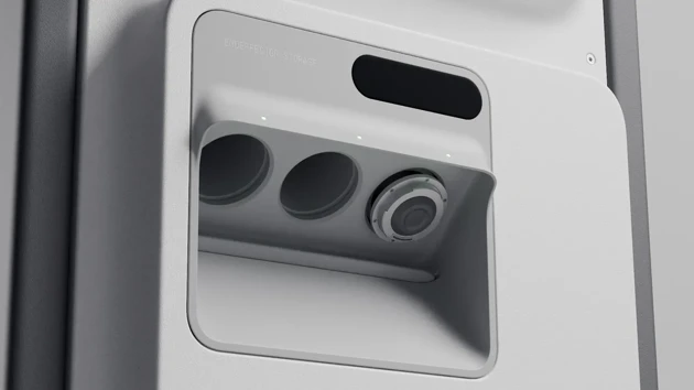
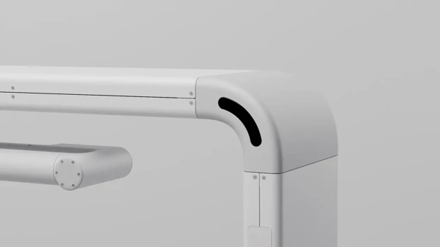
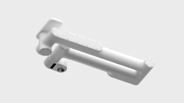
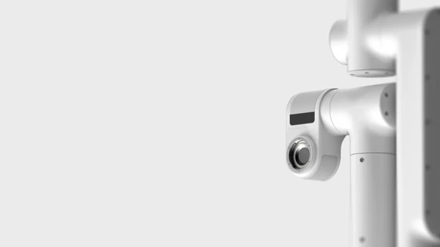
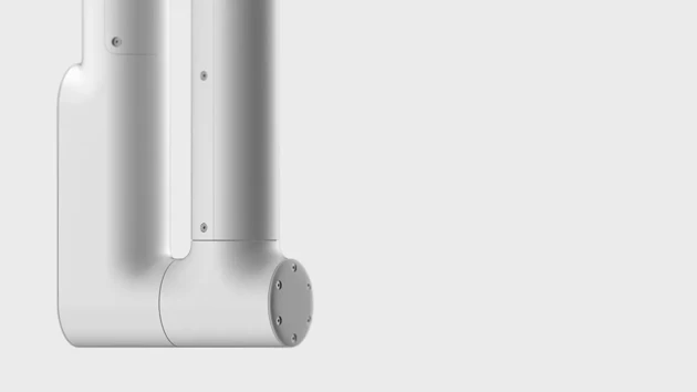
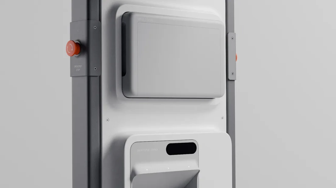
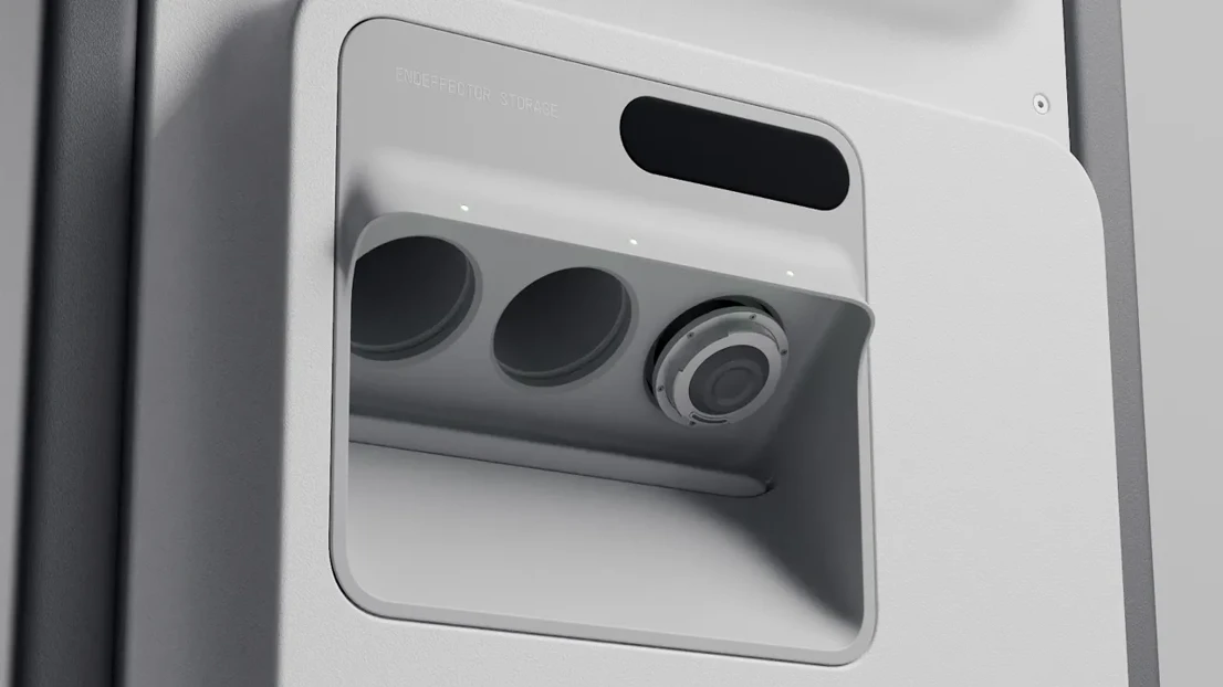
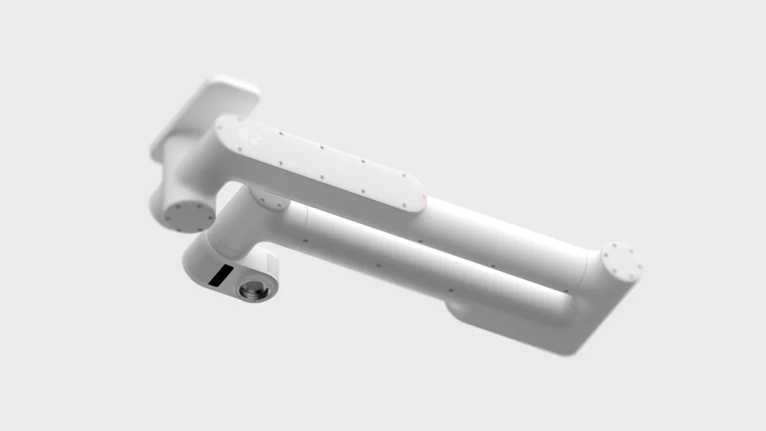
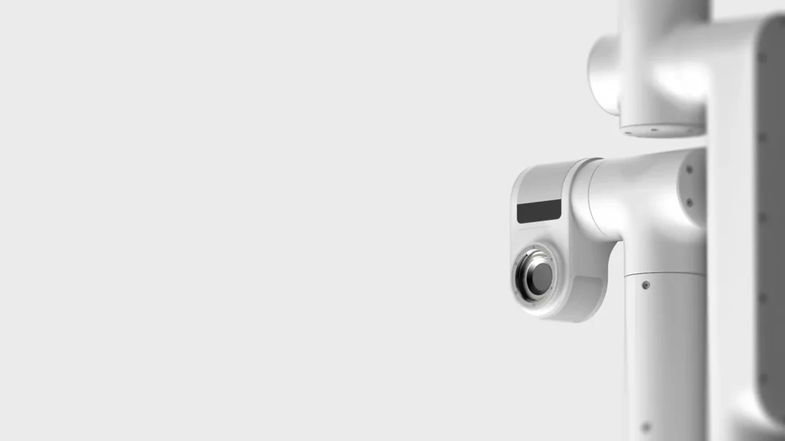
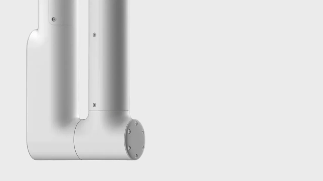
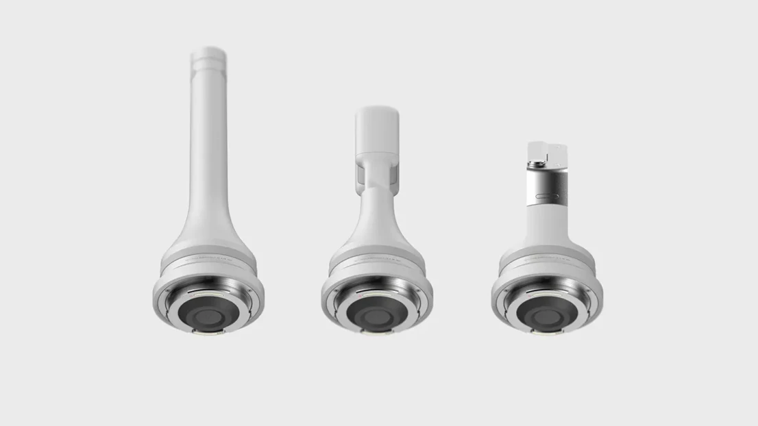
The crop parameters like nutrition and overall yield performance are measured by AI-enhanced cameras and the robotic arm. It’s doing this using multispectral cameras located on the inside of the rover’s structure. In case of detected irregularities, the robotic arm can choose between different end-effectors to examine the plant more in detail: a macro-camera, a nutrient tester and a sample-taker. The end-effectors are stored in a protected storage module and sealed by rubber gaskets.

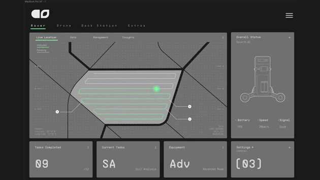
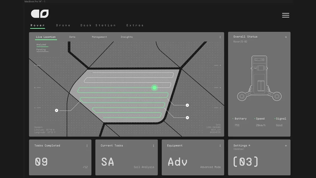
By continuously measuring the soil quality and the crop health, farmers can get valuable, precise information about their fields and the crop in the Agri Sense software. The software has extensive information about the majority of crops and helps the farmer to the develop and deploy the right strategies to improve yields and reduce costs and environmental impact. The farmer can also train the software with his own special knowledge and improve the functionality of the system. This also helps to pass on knowledge to future generations of farmers.

Another good use of the system is dealing with pests and diseases. The weather module of the station helps with predicting diseases, since the spreading of them is usually also dependend on weather. In case the rover finds infected plants, the farmer is notified immediately and he can choose to look right through the rover’s cameras on his phone to assess the situation. If it looks like an infection, the farmer can tell the rover to map the surrounding area in detail so he can see how far the infection spread. Once he has this information, he can precisely treat the sick plants while keeping the rest of the crop safe.
Indalecio Gaytan

Master's Programme in Advanced Product Design

Heinrich Zaunschirm

Master's Programme in Advanced Product Design

In collaboration with:

Link to website for project collaborator
Agri Sense is a data collection system helping farmers practice precision farming. The drone maps the fields while the Rover roams the  collects precise physical data, providing the farmer with valuable information about the soil and the crop.

Overview

Agri Sense is a data collection system helping farmers practice precision farming. The drone maps the fields while the Rover roams the  collects precise physical data, providing the farmer with valuable information about the soil and the crop.

Ideation 01

Agri Sense is a data collection system helping farmers practice precision farming. The drone maps the fields while the Rover roams the  collects precise physical data, providing the farmer with valuable information about the soil and the crop.

Ideation 02

Agri Sense is a data collection system helping farmers practice precision farming. The drone maps the fields while the Rover roams the  collects precise physical data, providing the farmer with valuable information about the soil and the crop.

Idaetion 03

Agri Sense is a data collection system helping farmers practice precision farming. The drone maps the fields while the Rover roams the  collects precise physical data, providing the farmer with valuable information about the soil and the crop.

Mockup 01

Agri Sense is a data collection system helping farmers practice precision farming. The drone maps the fields while the Rover roams the  collects precise physical data, providing the farmer with valuable information about the soil and the crop.

Mockup 02

Agri Sense is a data collection system helping farmers practice precision farming. The drone maps the fields while the Rover roams the  collects precise physical data, providing the farmer with valuable information about the soil and the crop.

Mockup 03

Agri Sense is a data collection system helping farmers practice precision farming. The drone maps the fields while the Rover roams the  collects precise physical data, providing the farmer with valuable information about the soil and the crop.

Drone 01

Agri Sense is a data collection system helping farmers practice precision farming. The drone maps the fields while the Rover roams the  collects precise physical data, providing the farmer with valuable information about the soil and the crop.

Drone 02

Agri Sense is a data collection system helping farmers practice precision farming. The drone maps the fields while the Rover roams the  collects precise physical data, providing the farmer with valuable information about the soil and the crop.

Drone 03

Agri Sense is a data collection system helping farmers practice precision farming. The drone maps the fields while the Rover roams the  collects precise physical data, providing the farmer with valuable information about the soil and the crop.

Interface

Agri Sense is a data collection system helping farmers practice precision farming. The drone maps the fields while the Rover roams the  collects precise physical data, providing the farmer with valuable information about the soil and the crop.

Rover detail 01

Agri Sense is a data collection system helping farmers practice precision farming. The drone maps the fields while the Rover roams the  collects precise physical data, providing the farmer with valuable information about the soil and the crop.

Rover detail 02

Agri Sense is a data collection system helping farmers practice precision farming. The drone maps the fields while the Rover roams the  collects precise physical data, providing the farmer with valuable information about the soil and the crop.

Rover detail 03

Agri Sense is a data collection system helping farmers practice precision farming. The drone maps the fields while the Rover roams the  collects precise physical data, providing the farmer with valuable information about the soil and the crop.

Rover detail 04

Agri Sense is a data collection system helping farmers practice precision farming. The drone maps the fields while the Rover roams the  collects precise physical data, providing the farmer with valuable information about the soil and the crop.

Rover detail 05

Agri Sense is a data collection system helping farmers practice precision farming. The drone maps the fields while the Rover roams the  collects precise physical data, providing the farmer with valuable information about the soil and the crop.

Rover detail 06

Agri Sense is a data collection system helping farmers practice precision farming. The drone maps the fields while the Rover roams the  collects precise physical data, providing the farmer with valuable information about the soil and the crop.

Robo arm 01

Agri Sense is a data collection system helping farmers practice precision farming. The drone maps the fields while the Rover roams the  collects precise physical data, providing the farmer with valuable information about the soil and the crop.

Robo arm detail 01

Agri Sense is a data collection system helping farmers practice precision farming. The drone maps the fields while the Rover roams the  collects precise physical data, providing the farmer with valuable information about the soil and the crop.

Robo arm detail 02

Agri Sense is a data collection system helping farmers practice precision farming. The drone maps the fields while the Rover roams the  collects precise physical data, providing the farmer with valuable information about the soil and the crop.

End effectors

Agri Sense is a data collection system helping farmers practice precision farming. The drone maps the fields while the Rover roams the  collects precise physical data, providing the farmer with valuable information about the soil and the crop.

Battery swap 01

Agri Sense is a data collection system helping farmers practice precision farming. The drone maps the fields while the Rover roams the  collects precise physical data, providing the farmer with valuable information about the soil and the crop.

Battery swap 02

Agri Sense is a data collection system helping farmers practice precision farming. The drone maps the fields while the Rover roams the  collects precise physical data, providing the farmer with valuable information about the soil and the crop.

CAD iteration