Result 1
SEIDR
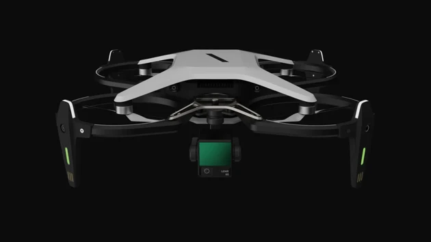
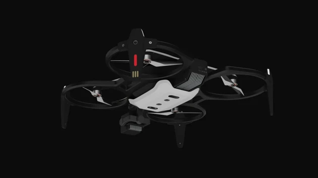
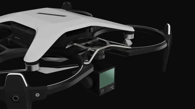
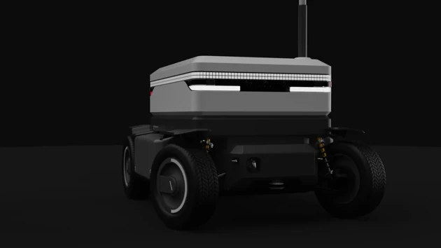
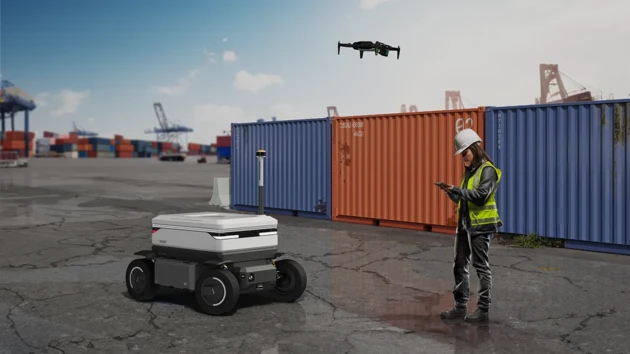
Many workflows in the logistics industry could be converted to autonomous solutions to improve efficiency, safety and sustainability, but the introduction of autonomous vehicles is not always easy. Detailed 3D maps are an important foundation for AEVs to navigate in complex environments. The SEIDR mapping kit consists of a drone for aerial mapping and a vehicle for terrestrial mapping, refinement, testing and simulation. The user selects the relevant area and is guided through the mapping process. With the help of AI systems, SEIDR creates a detailed 3D map and a digital twin of the site. Introducing the future of logistics, ready for commercial operation.
SEIDR - LiDAR Mapping System
Project Background and Scope
The logistics industry is undergoing a major shift towards the use of autonomous electric vehicles to transport and distribute goods between manufacturers, logistics hubs and customers. Detailed three-dimensional maps form the foundation for this future of automation. Especially in complex environments such as harbours, freight terminals and logistics hubs, detailed 3D maps are essential.
Today, this scanning process, which is usually carried out by remote-controlled vehicles, is time-consuming and labour-intensive and requires extensive post-processing.
Our solution aims to enable a quick and effortless transition to autonomous logistics in the future. The product we have developed is easy to use, carries out the mapping independently and creates a digital twin of the scanned location. This digital twin can then be used to test, simulate and optimise processes to improve efficiency, safety and sustainability through autonomous solutions.
Methods
In the initial phase of the project and during the collaboration phase, we conducted numerous field studies and worked with various companies in the logistics sector. During these visits, we conducted interviews with the employees of each company, gaining valuable insights that fed into the project design for more relevant solutions. We also visited Einride to experience first-hand the operation of autonomous electric vehicles and gain insights into the complexities involved. After an extensive initial research phase and sharing our findings
in joint brainstorming sessions, we chose mapping for autonomous vehicle as one of the most relevant topics.
We expanded our research to gain a detailed understanding of how lidars work and identify relevant design opportunities. During this phase, we had the valuable opportunity to interview experts from Einride, Kvarkenports and Dronenerds. The knowledge provided by the engineers, software developers and drone experts allowed us to validate our initial assumptions and ideas.
We then refined our ideas and divided them into three different concepts. With input from the Einride design team, we settled on one concept. To further validate and refine it, we conducted ideation sessions where we carefully selected the scope and scenario for the concept. These sessions helped us to identify the key features that our concept should include.
Once we had defined all the components and rough dimensions, we entered an iteration phase where we experimented with different shapes and features through sketches and quick CAD modelling. After a joint session with the Einride team, we refined our design and eventually created the final version of the product.
Results
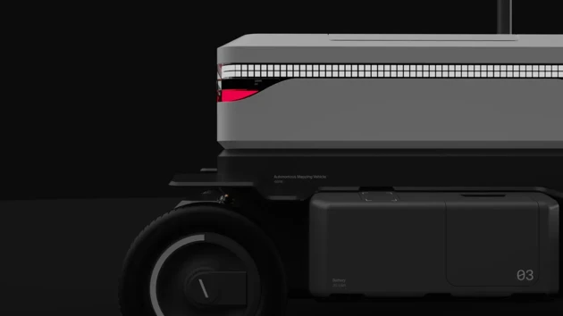
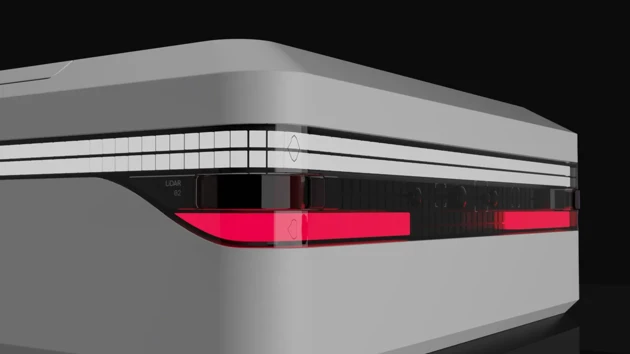
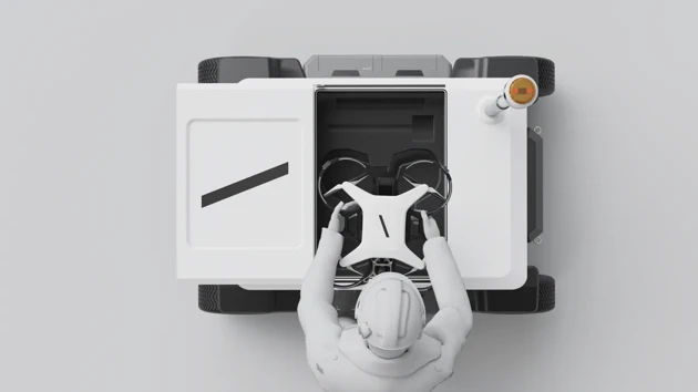
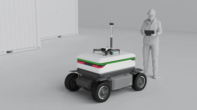
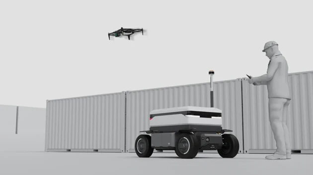
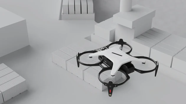
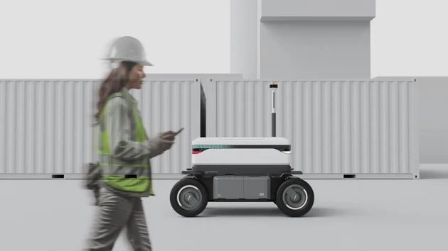
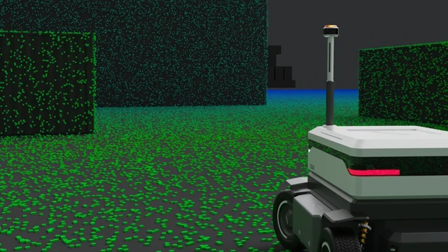
Our final design is the SEIDR LiDRAR mapping system, which consists of a drone for aerial mapping and a vehicle for terrestrial mapping, refinement, testing and simulation. SEIDR is transported to the construction site on two Euro pallets. A Einride employee takes care of the unpacking. He sets up the lidar mast and an RTK antenna for a precise and accurate mapping process and connects them to the vehicle. Everything is then easily controlled via an Ipad. The desired mapping area is selected and a flight pattern for the drone is created with the help of AI. The drone is set on the landing pad on the vehicle and takes off to create a three-dimensional scan of the area. The vehicle later takes over the scan and refines it. It can recognise temporary geometries such as containers or other vehicles and mark them on the map. Once the mapping is complete, the vehicle can simulate and test different types of autonomous vehicles and create a digital twin of the scanned location. This digital twin can then be used to test, simulate and optimise processes to improve efficiency, safety and sustainability through autonomous solutions. With the SEIDR Lidar Scanning System, Einride enables a fast and effortless transition to the autonomous logistics of the future.
Lenz Connor Bätzing
Julius Bahl
Result 2
Result 3
Result 4
Result 5
Result 6
Scenario 1
Scenario 2
Scenario 3
Scenario 4
Scenario 5
Scenario 6
Final result


