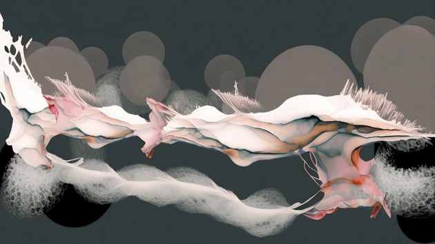
Ebba Landstedt & The life and death of an Arctic phenomenon re-imagining the landscape of the post-industrial palsa mire. Ecological significance of Viššatvuopmi as one of Sweden’s largest palsa mires complexes, facing water reservoirs, biodiversity and carbon storage.
Image:Ebba LandstedtMan-made Geographies. From Planetary to Molecular
How can we visually convey the depletion of ecosystemic bodies and cultural geographies caused by industrial forces? How can intersectional cartographic representation heighten climate awareness by revealing the fragility of these ecosystems? Can we envision these scarred and violated lands as post-industrial Edens of high natural and cultural value through landscape remediation and social/ecological restorative practices? How can we address these challenges on scales ranging from the molecular to the planetary, creating new ecological narratives and visionary hypotheses for urgent ecological challenges in the near future? Responding to Climate Change in Norrland and the Arctic Region, the studio embarks on a journey of critical investigation, addressing environmental violence and disruptions. Drawing inspiration from historical paths and routes laid out by people for centuries, we seek to resonate history through visions for the future. By revitalizing affected landscapes with new micro-economies, legal frameworks, and natural values, students envision carbon-free geographies and innovative multispecies landscapes. This involves developing transitional protocols, responsive infrastructures, material reengineering, bio components, and living systems.
1 / 1
Context of investigation
Building upon McHale's concept of the "Planetary Housekeeping," the studio explores correlations between social landscapes, ecosystem services, and post-industrial geographies. The goal is to create a global atlas for a diplomacy and advocacy project addressing conflict zones and environmental constraints. Studio 12 investigates territorial injustice in Nordic geographies, uncovering hidden scenarios of infrastructural violence and environmental degradation. The multimedia representation showcases territorial injustices and infrastructural violence across Arctic geographies. The students envision long-term remediation strategies for areas scarred by extractivist practices and human exploitation, landscape eco-infrastructures linking disrupted ecosystems, and free energy managed by community grids.
Studio Agenda and Methodology
Students engage in research, developing intersectional cartographies and collaborative living maps. By mapping complex geospatial data, the projects construct a 3-dimensional research environment to study disruptive phenomena, denouncing agents of disturbance and the exhaustion of exceptional ecological resources. The methodology encompasses mapping of complex geospatial data using intersectional cartographies to study disruptive phenomena and denounce agents of disturbance. The projects are supported by workshops on complex territorial modeling, 3D printing, AI seminars, and transscalar material investigations. The result is a set of research catalogues that prototype mediating forms and bio structures in response to the studied harmed and damaged ecologies.
Studio Teachers: Alejandro Haiek Coll (studio responsible), Johanna Runge, Julio Diarte.
Latest update: 2023-08-30